Don't Bother Checking the Weather When Traveling to Ecuador
How will the weather be on my motorcycle tour in Ecuador?
When planning a motorcycle or 4x4 adventure in Ecuador, you will notice that you will get lots of different, conflicting, and sometimes confusing information if you ask what weather to expect. This is not due to any character fault of the Ecuadorian people, nor due to tour operators trying to sell a spot on their next tour - it's just that the weather here is quite entirely unpredictable. You've probably heard that jokingly about many places, but it truly is the scientific reality and not just a funny exaggeration in Ecuador.

You will notice no weather forecasts on the evening news or in newspapers when you get here. There are lots of news, sports, and cooking segments, but never a meteorological report. If you look up the weather forecast on internet sites, they will indicate a chance of rain, day after day. Even during Quito's severe drought in August 2012, when it didn't rain for 34 days and while several forest fires threatened the city, accuweather.com and yahoo predicted rainfall every day. As usual!
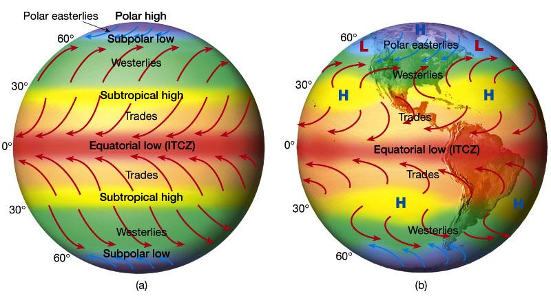
There are many reasons why it's just not possible to predict the weather accurately. The principal reason is that Ecuador is located in the “tropical convergence zone,” or the area that pirates and sailors refer to as “the doldrums” - the area of the world's seas where there are no trade winds, and the sailing is slow.
The Doldrums
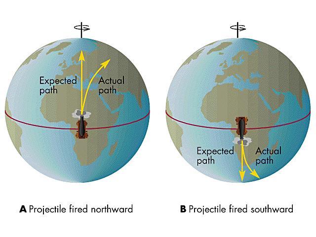
The doldrums are due to the Coriolis effect. The key to the Coriolis effect lies in the Earth’s rotation. Specifically, the Earth rotates faster at the Equator than it does at the poles. Earth is wider at the Equator, so to make a rotation in one 24-hour period, equatorial regions race nearly 1,674 kilometers per hour (1,040 miles per hour). Near the poles, the Earth rotates at just .00008 kph (.00005 mph).
Let’s pretend you’re standing in Quito, and you want to throw a ball to your friend in Des Moines, Iowa. If you throw the ball in a straight line, it will appear to land to your friend's right because he’s moving slower and has not caught up.
Fluids traveling across large areas, such as air currents, are like the ball's path. They appear to bend to the right in the Northern Hemisphere. The Coriolis effect behaves the opposite way in the Southern Hemisphere, where currents bow to the left. Hurricanes and tornadoes in the northern hemisphere spin counter-clockwise while cyclones in the southern hemisphere spin clockwise.
So, in the middle – the tropical convergence zone – they cancel each other out. It is why it is scientifically impossible to have tornadoes or hurricanes in Ecuador.
The convergence area prevents the formation of strong high- or low-pressure ridges in the atmosphere, as are common in high and low latitudes. These clear-cut zones make predicting the weather in North America and Europe a lot easier. In Ecuador, without these zones, the forecast is anyone's guess. However, Ecuador's lack of clearly differentiated pressure zones creates weather patterns that can last for days or weeks. So, if today had a drizzle in the morning and bright sun in the afternoon, you can pretty much expect the same weather pattern tomorrow.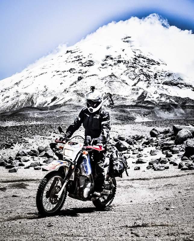
The change in pattern is usually preceded by 24 hours of very different weather, such as a day of rain or a day without a cloud in the sky.
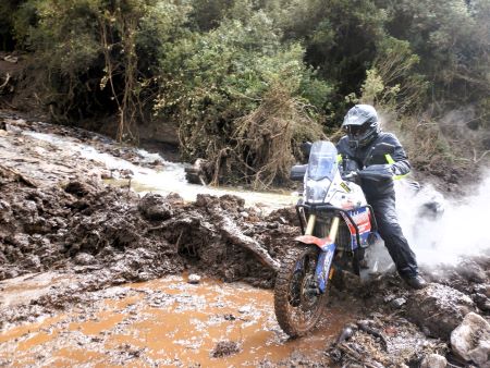
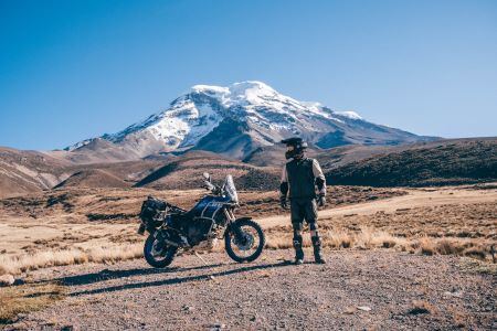
 High elevations in Ecuador can produce rare and unexpected weather events, including intense hail storms that leave heavy accumulations. We have had three or four hail storms in Quito over the past ten years, which left several inches of winter wonderland on the ground. When you cross through the Chimborazo National Wildlife area on the road at 14,500 feet elevation, you may face snow, ice, or a warm springlike day. You never know until you get there.
Making weather forecasts even more difficult is because Ecuador is bordered on one side by the world’s largest ocean and the other by the world’s largest jungle and is bisected by the world’s second-largest mountain range. To add another twist, one of the world’s strongest ocean currents, the Humboldt, runs several hundred miles off-shore.
“If you don't like the weather, ride 15 miles in any direction.”
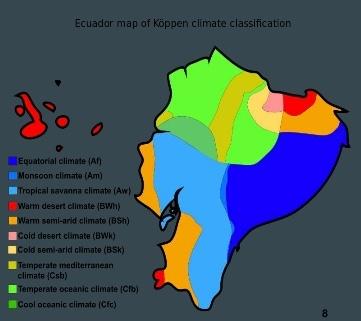 Ecuador has ten general climatic zones and even more “micro-climates” spread throughout the country. The weather and temperatures can be significantly different, just a few miles or hours apart.
This means that having a general forecast for the country is just not possible. When riding around the country, you can expect – and should prepare for – widely varying temperatures and weather as you roll through various regions, climates, and elevations.
When you visit Ecuador, you will have to forget everything you know about “seasons.” Ecuadorians – especially Quiteños - use the words “summer” and “winter” to describe weather events all year long. If it rains or is cloudy or exceptionally cool for a few days, they'll call it “winter.” A few days later, when the sun is out, and people complain about the scorching 75-degree daytime highs, it’s “summer.” You can likely expect both a summer and winter during your trip here, even if only a few days.
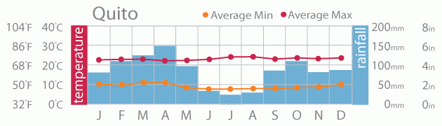
Temperatures are pretty much the same all year. Apart from the rainforests or the desert areas, most places in the country get about the same average precipitation as New York and Chicago. There is no single “best time” to visit the country – as different weather patterns affect the other regions at different times. One thing is sure, though – the chance of beautiful weather somewhere in the country is very high, just about every day of the year. The temperature in Ecuador varies by altitude and weather conditions. A cloudy day at 6,000 feet (1,800m) can be pretty chilly, but down at 1,000 feet (300m) near Tena, it’s warm on rainy days. Usually, you'll see sunny skies for part of the ride and passing showers for another, but an entire week of rain is not typical.
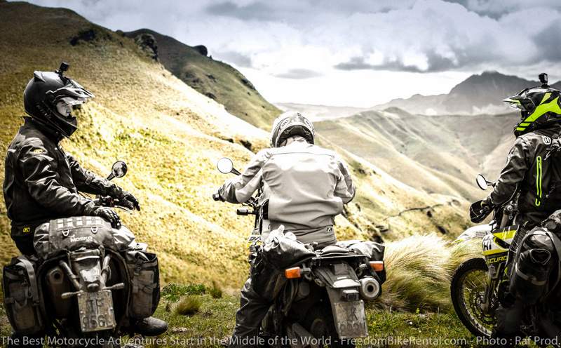
What makes Ecuador an exceptionally great place to ride an adventure motorcycle or explore in a 4x4 is that the weather, despite being unpredictable, is consistently so all year long, with some general patterns in each different region, which we will outline below.
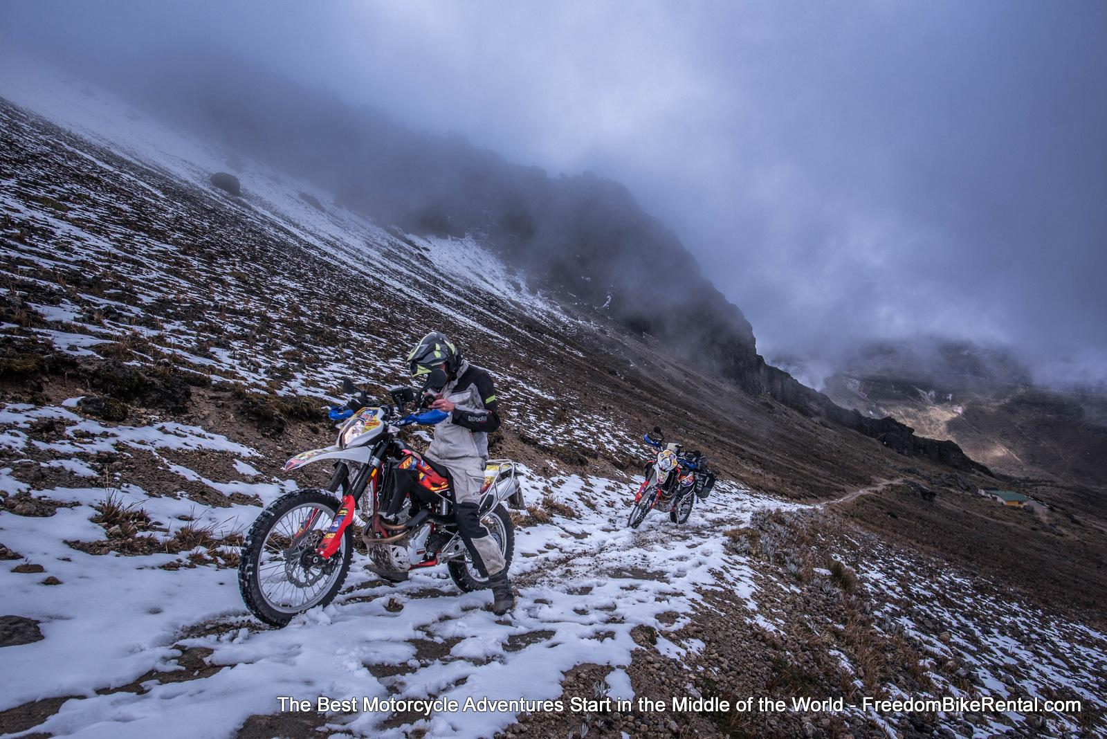
The Andes
The high altitude of the Andes in Ecuador influences the weather there. When traveling through the “Avenue of the Volcanoes,” the snow-capped peaks of Cotopaxi, El Altar, and Cayambe greet you under blue skies in the morning. They are often lost in cloud cover and sometimes rain during the afternoon.
Temperatures can drop to around 50 °F as you go higher and typically reach approximately 78 °F during the day. Passing showers become another element for a motorcycle adventure between November and May.
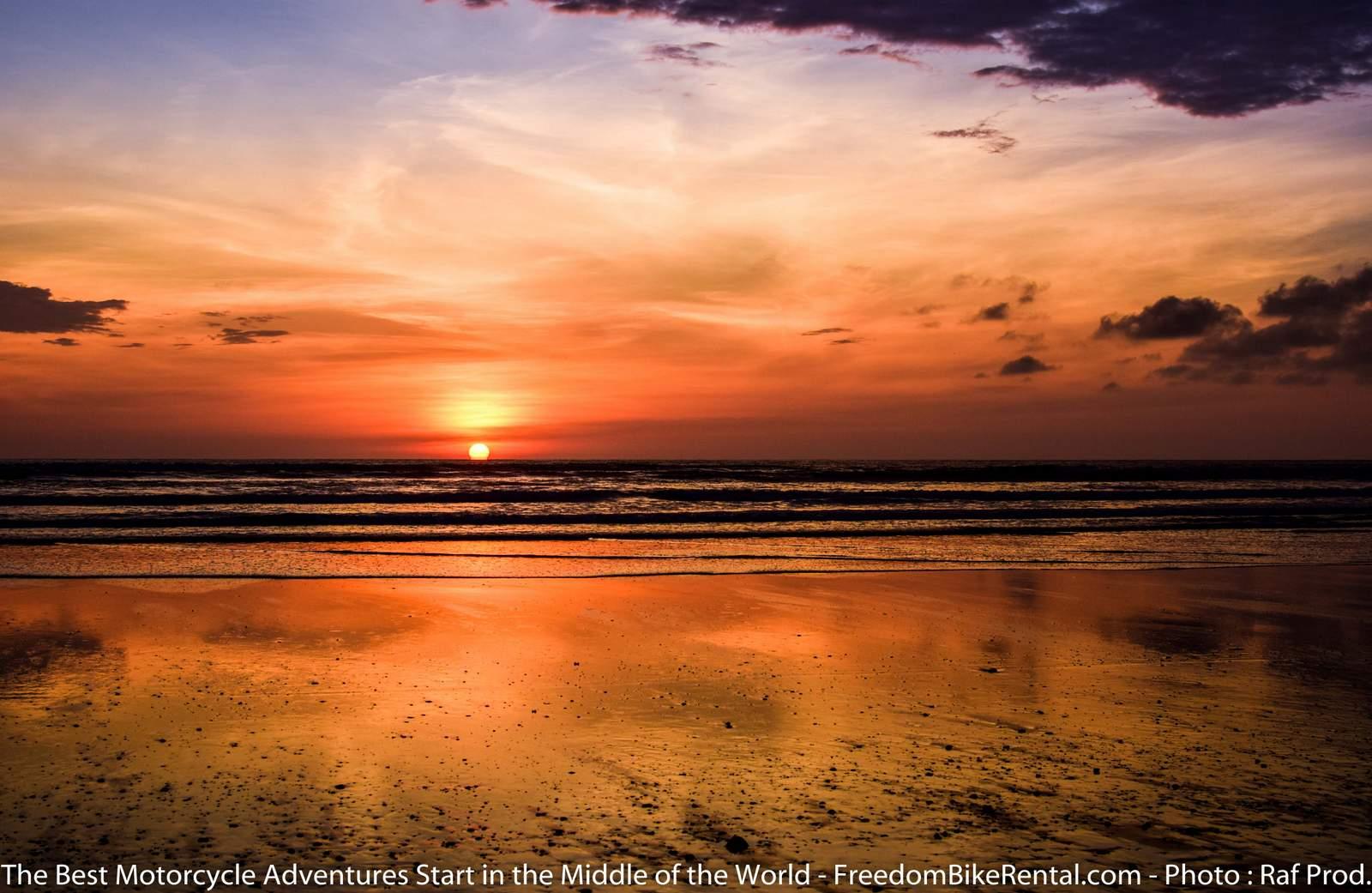
The Coast
The high season along Ecuador’s coast and the Ruta De Sol is between December to April - the wet season. Despite moderate rain showers, the skies turn blue, and the temperatures can reach 90°F.
The cool Humboldt Current takes center stage between June and December-lowering air temperatures and bringing an annual infusion of humpback whales to the waters off the rocky coastline.
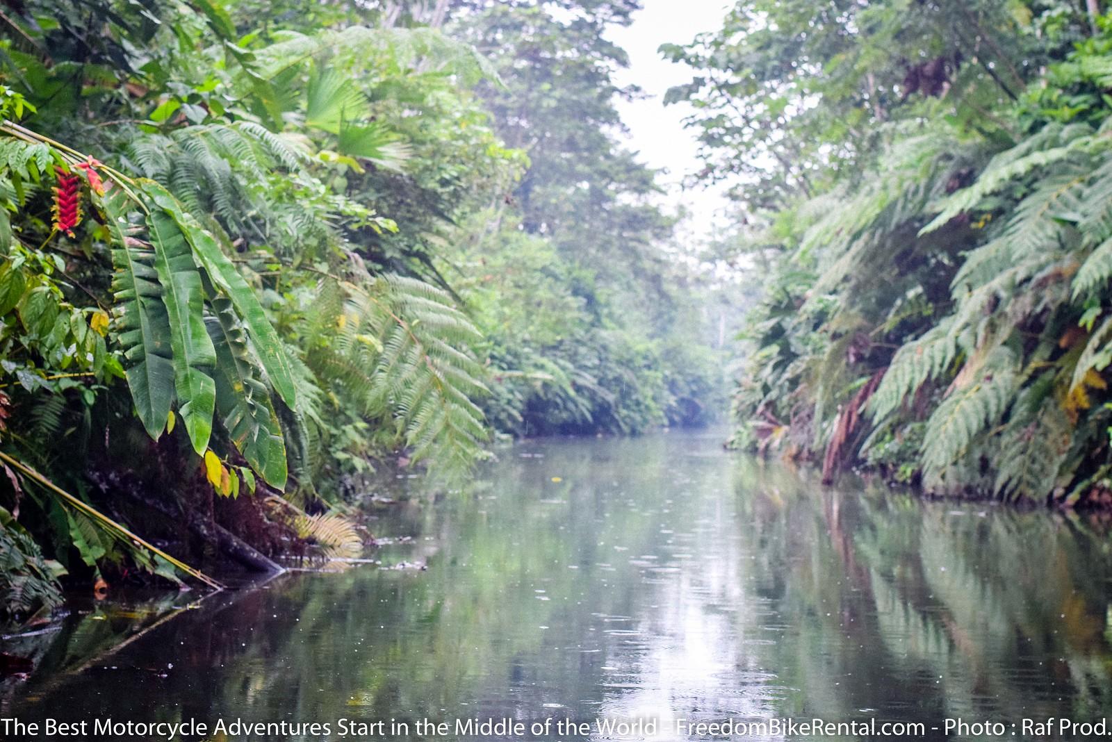
The Amazon Basin
El Oriente, or the Amazon jungle, plays by its own rules regarding just about everything. The incredible number of plants and animals that live here thrive because the average rainfall can be as high as 175 inches each year.
The dry season here is between December and February. There is still rain, and the temperature doesn’t drastically change-the average being between 79°F and 95°F all year-round. The most rain falls between April and July.
As a rule of thumb, the jungle is hot, muggy, and wet-but the trade-offs are an astonishing amount of wildlife under blue skies when the cloud cover breaks. Monkeys swinging in trees, toucans flying overhead, and the nightly cacophony of the insect world bring a new sense of wonder to a trip.
The Galapagos Islands
The temperate weather in the Galapagos Islands changes with the currents, like the coast. During the Garúa season between July and December, the climate and ecosystem are affected by the Humboldt Current. The waters and the air cool while daily rain showers and mist replenish the islands' dry highlands. This means more active marine life-including a bevy of whales and mating seasons for many of the islands ´mammals and birds.
The dry season sees warmer waters between December and June as the Humboldt Current recedes and sunnier, albeit drier, skies. The wildlife recedes a bit without the cool waters or rainfall, but this time is typically the busiest in the archipelago.

What to wear on a motorcycle adventure tour in Ecuador.
The key to dressing in Ecuador is to wear layers under riding gear with versatile ventilation.
Ecuador Freedom Guides typically wear during a motorcycle adventure tour: This remains the same all year long.
- Sea level to 5,000 feet: Klim Badlands Jacket over a t-shirt, Klim Badlands Pro, or Carlsbad Pants over a Klim Agressor Cool base layer. Lightweight summer riding gloves. The Klim Artemis line is perfect for Ecuador and very similar to the Badlands jacket for women ArtemisArtemis line is ideal for Ecuador and very similar to the Badlands jacket.
- 5,000 feet to 11,000 feet: Klim Badlands Jacket over a t-shirt, Klim Badlands Pants over a Klim Agressor 2.0, or Underarmour base layer. Lightweight summer gloves
- 11,000 – 13,000 feet: Klim Badlands Jacket over a t-shirt and motocross jersey or long-sleeved t-shirt, Klim Badlands Pants over a Klim Agressor 2.0 or Underarmour base layer. Heavier, waterproof riding gloves.
- 13,000 – 15,000+ feet: As above but with a 100% wool sweater over the t-shirt and MX jersey.
That's it. Very simple and easy to change and adjust during the day's ride. There is no need for electrically heated vests or riding gloves. Low temperatures are only at the peak elevations, and those are generally brief periods. If you stick to these guidelines, you will be comfortable on your entire ride.
Remember, when you book any self-guided motorcycle tour or 4x4 adventure tour, or guided motorcycle adventure tour in Ecuador with Ecuador Freedom, you can purchase riding gear from our partner, Klim, at a 20% discount. It is a great way to prepare for your trip while potentially saving hundreds of dollars on the best riding gear on the planet.
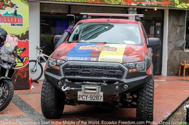
Ecuador Freedom - Experience, Gear, Equipment, and Support
Ecuador Freedom offers many motorcycles with heated grips, which reduce your need for extra gloves and make riding in higher elevations more comfortable.
Ecuador's consistent springtime weather is a significant draw for those seeking a motorcycle adventure that raises the bar for a trip worth writing home about. Ecuador Freedom’s experience in outfitting motorcycle adventures in the middle of the world extends to providing the right gear, equipment, guides, and advice to circumvent the climate's practicalities. Our team has traversed the country hundreds of times during our tenure here and is on hand, in person or by phone, to help with bumps in the road if they occur. Contact a team member to start the ball rolling for more information about a motorcycle adventure in different Ecuador regions. Contact a team member to start the ball rolling.